One of the key features for the customer journey is the ability to provide reasonably precise location information without requiring a map.
Digital maps are brilliant, I love them and use them all the time, so I’m definitely not knocking maps. The trouble is our old map based reporting system generated a mountain of negative feedback from visually impaired and digitally excluded members of our communities, who found the operation of digital maps next to impossible.

Give the user options
“Why do I have to use this stupid map? Can’t I just tell someone where it is?”
Good point user, but instead of ‘someone’ why not provide the user with a few different options to self serve the location?
And even better, if you are standing next to the fallen tree for example, let’s use the location settings on your mobile device to provide the location so you don’t have to.
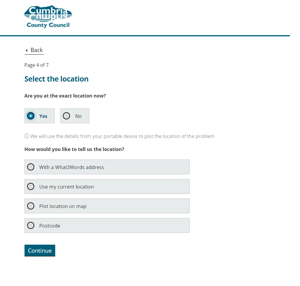
Our first improvement is to introduce the question “Are you at the exact location now?”
Answering “Yes“, presents our next question “How would you like to tell us the location?” and four options:
- With a What3Words address
- Use my current location
- Plot location on map
- Postcode
(If the user selects “No”, the option to use the current location is removed)
What3Words
This is the 3 word addressing system that wraps the planet in a grid of 3 meter x 3 meter squares and gives each square a three word address.
goat.copies.jams is the 3 word address for the front door of Cumbria House in Carlisle, and juices.erase.united is the 3 word address for the back door of Cumbria House in Carlisle.
By selecting this option the user is actually presented with the 3 word address for their current location and they can also replace this with another 3 word address.
Current location
The user is prompted to enable location services on their mobile device and their location is captured by our form as latitude and longitude coordinates.
A map
We’ve kept the map as an option, it is the preferred choice of 58% of user submitted reports. Our map is actually an integration to the Highways management system, clicking/tapping the map fires an API call from that system to our system and includes the latitude and longitude of the point selected on the map.
Postcode and street address
This option uses a couple of integrations to allow the user to firstly select a street address from the postcode provided. Then secondly, unknown to the user we make an API call to the Ordnance Survey Data Hub and receive coordinates for the property selected.
Describe the location in more detail
Using one of the above options is mandatory to help ensure the system receives decent data. We also require the user describes “the location in more detail”. How much detail they provide is up to the user, some cheat, but most use this input box to provide valuable information to our triage teams.
Pulling it all together
You might be wondering how the Highways service deal with so many different types of location data? The magic behind that is they don’t, they work with the data type they prefer. It doesn’t matter how the user reports the location, because in the background the system automatically uses integrations to convert all location types to the others.
Every customer report has;
- Latitude and longitude
- What3words address
- Easting and northing
- Coordinates plotted on a map
- Nearest postcode
- Nearest address if applicable
Is it better?
We’ve had some amazing feedback. A blind person said
I am blind and I’ve been able to report problems on both my computer and on my phone. I’ve never been able to report anything before, thank you.
Linda, Cumbria
We’ll continue to monitor feedback and look for improvements. Since go live we have received over 16000 customer reports through this service and the break down of location preference is:
| How would you like to tell us the location? | Count |
| What3Words | 1005 |
| Current location | 550 |
| Map | 9501 |
| Postcode and address | 5067 |
Integrations
Making this all work has required a few integrations to other systems. We’ve used What3Words developer API, GetAddress.io, Ordnance Survey Data hub.
We’ll cover the technical details of each in other posts…